

| Carlos Montoya
Thermography (heat inspections using thermal imagery) uses differences in temperature captured with thermal imagery to locate precisely where energy is being lost. By identifying these energy losses, we conserve and reduce total energy consumption and wasted natural resources.
Due to the continuous improvements in thermal imaging sensors, software, and aerial mapping platforms, we can significantly improve energy efficiency assessments and resource management of facilities. The latest aerial thermal sensors expedite visualization and interpretation of temperature signatures for entire surfaces to facilitate data-driven decisions for facility and resource management.
Aerial Thermal Surveys for Engineering Applications
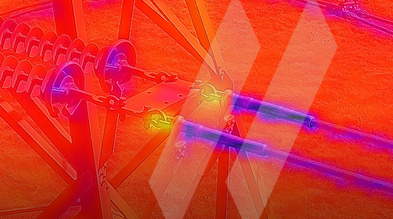
For difficult-to-access inspection areas, unmanned aerial systems (UAS) are a good option. Compared to traditional boots on the ground inspections, data from aerial thermal surveys can more quickly identify energy efficiency problems over a large complex. Electrical transmission and distribution lines are regularly monitored using UAS to collect thermal imagery to identify electrical component anomalies.
Combining Thermal and RGB Data
Pairing thermal and RGB (natural color imagery) sensors provides visual awareness and context to accurately spot anomalies in the field and effectively monitor natural resources. Dual sensor systems collect larger amounts of data that need to be stored and analyzed; however, the benefit of the RGB data is so valuable that it should not be optional. A thermal-only payload could potentially lead to errors. For instance, non-electrical issues like soiling and shading could lead to false positives by misidentifying these issues as electrical anomalies. The use of both thermal and RGB data allows redundancy and expanded situational awareness for proper visualization and interpretation. RGB data is captured vertically (90 o) and/or at an angle (usually 45o). If evaluating flat built-up roofing systems or underground steam lines, nadir (vertical) collections are suitable. If exterior walls or complex structures are required, then oblique (at an angle) collections are crucial.
Recently, SAM completed 3D documentation of over 100 underground electric vault structures throughout a dense urban environment for a major utility. SAM utilized state-of-the-art 3D laser scanning technology with integrated thermal and HDR color cameras to accurately document each vault. The multi-sensor approach captured 360° panorama scans in a fully automatic process, and without risk to crews entering confined space. The method provided a safe and efficient solution to co-register LiDAR, color and thermal imagery for analysis and condition assessment.
An Innovative Fixed-Wing Platform
Aerial thermal surveys with fixed-wing have great potential for engineering, environmental planning, and land development. Buildings, parking lots, pavements, and other man-made features are easily separated from unpaved and vegetated areas as thermal signatures are different for each feature type. Water resources and the network feeding into these water sources become clearly visible with thermal imagery despite of surrounding vegetation, allowing monitoring and evaluation of such resources. Thermal surveys also provide a valuable tool for engineering and scientist evaluating subsurface environments of shallow water bodies like lakes and ponds.
SAM has designed an innovative fixed-wing acquisition platform with leading-edge functionality for engineers and scientists that integrates the most advanced thermal, imagery, and LiDAR sensors. The entire system is mounted on a SAM aircraft and is capable of capturing thermal imagery, LiDAR, vertical color photography and oblique simultaneously. Thermal sensing technology enables measurement of the temperature of an object in every pixel of the image and interfaces with a GPS system to capture the exact position in space of each thermal image. Aerial thermal images are co-located spatially to form a seamless mosaic that easily incorporates into existing GIS databases. LiDAR data enables information related to as-built conditions, encroachment measurements, vegetation growth, as well as development of digital elevation models.
SAM’s fixed-wing acquisition platform is a unique multi-sensor system that allows simultaneous measurements of as-built conditions, vegetation structure, terrain conditions, and surface temperatures at very high spatial resolution. The complementary nature of LiDAR, optical and thermal data offers an analytical framework for the development of new algorithms to map vast amounts of land and facilities for innovative engineering and environmental applications. The multi-sensor system was specifically designed to simplify deployment and minimize collection and data processing costs.
Pioneering solutions like these facilitate the management and conservation of resources to pave the way toward a more sustainable world. To learn more about SAM’s unparalleled approach to aerial mapping and inspections visit our website.