

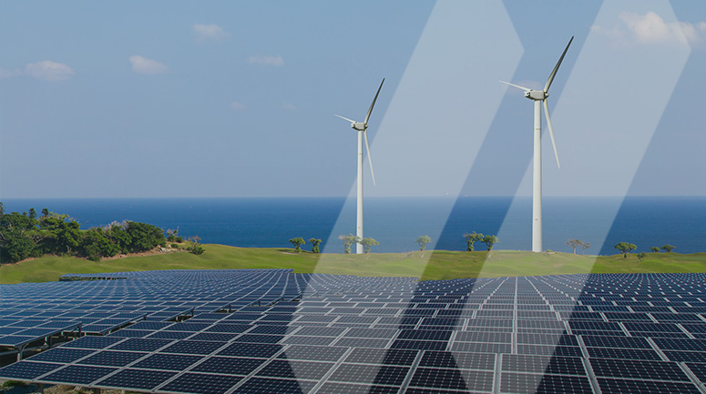
As the United States' energy grid ages and the longer, hot summers continue, meeting the growing energy demand has increasingly become challenging, especially as reliability is paramount. Ramping up power generation is key to meeting this need, and renewable sources like wind and solar farms are at the forefront of the national infrastructure initiatives for more power. On the one hand, these natural sources are plentiful. On the other, prime locations with continuous sun or wind are often isolated and hard to reach, like the barren Sonoran Desert of the Southwest. For prospective renewable developers, this means building new, state-of-the-art infrastructure in places where there was little, if any, supporting infrastructure. It is the first step in a herculean undertaking—creating a modern, renewable, efficient grid for the energy-insecure regions of America.
Aside from the power generation sites, there must also be a way to deliver the power where it is in demand. To do so, developers are faced with constructing transmission lines that bring the energy where it is most needed.
The most ambitious example is a recent transmission program undertaken, which makes up half of a broader wind generation parent program. It consists of a pair of 525kV HVDC transmission lines covering roughly 550 miles, traveling through Arizona and New Mexico, spanning twelve counties of federal, state, and private lands. It has the capacity to transport over 3.5 GW of clean, renewable energy, making it the largest of its kind in the hemisphere, with the ability to power millions of homes in the population centers.
This initial phase has been a feat in and of itself, and the SAM team was gratified to see the transmission line break ground earlier this year and begin the construction phase. Due to the widely varying landscapes and challenges, as well as property owners, community members, and concerned environmentalists keeping a close eye, it only recently acquired the final approval to start development from the federal authorities, official as of fall 2023. Our team has spent over nine years supporting the planning and design phase, ensuring the optimum route, acquired easements, and legalities were secured before the first shovel hit the dirt.
SAM was selected for our trusted, knowledgeable, and innovative services led by industry veterans like Sue Weiss, a senior program manager with decades of industry experience.
Sue Weiss's experience brings a unique perspective to the singular nature of this undertaking. With much of her experience rooted in the energy market, Sue offers her view on how Geographic Information Systems (GIS) usage and importance have fundamentally shifted in past decades. "I think GIS makes it easier for everybody to have insight into all phases," she said, "I can give you a PDF set of plans, and I can give you an exhibit, but GIS allows you to see spatial data and surrounding geography, including the orthophoto imagery, graphic and non-graphic features. GIS allows everyone to view geospatial data in its most basic form, even for laymen. It allows stakeholders to analyze the spatial data in real-time, have insight into the progress and status, and facilitates the faster resolution of issues, thereby improving the communication and quality". Not only is GIS used more often, with the platform providing more efficiency, but it's also used by other stakeholders in vastly different roles at an enterprise level while connecting multiple locations and functions.
These capabilities make it especially relevant in a public-facing endeavor. Multiple stakeholders in different roles collaborate and communicate with greater fluency and frequency while referencing a common operating picture. It demonstrates how complex undertakings of this size and magnitude are becoming increasingly streamlined. In Sue's words, "That is the beauty of GIS. Because you can add attributes to the features, many variables can be queried to provide greater insight into making better-informed decisions. The political boundaries, land parcels, easements, access points, restrictions, topography, and environmental conditions are all viewed in a virtual digital world."
The SAM GIS team's first opportunity developed when client managers struggled to find a solution to cross-check its land-ownership database with existing land tracts efficiently. Despite the difficult nature of this task, SAM's deep experience in cadastral mapping made it possible to provide a solution promptly, opening the door to further geodatabase management support. This trusted partnership increasingly grew, both in scope and scale. SAM helped the client's internal GIS team manage, host, and reorganize data, making it easier to share and collaborate. These broad changes implemented with SAM's assistance helped strengthen the partnership, particularly with geospatial data review, map and database updates, and general sharing of GIS best practices. The partnership expanded as the construction phase began, adding more dependency on the enterprise GIS and spatial data management. This solution is a great example of how a holistic Managed Geospatial Service™ offering can provide tools for decision support that enable clients to achieve their strategic objectives.
SAM's comprehensive services and storied reputation for excellence made us an ideal fit for the largest renewable project in U.S. history. Our vision is to advance spatial data acquisition, improve analysis capabilities, and develop predictive analytics to support programs of this nature. We have established a reputation for turning complex spatial data into practical, accurate, and high-fidelity deliverables to enhance decision-making, mitigate risks, achieve strategic objectives, and help drive costs out of our client's business.