

| Bob Williams
Oil and Gas pipeline operators are committed to safety and sustainability through industry-led reporting, standards-setting, and performance initiatives that have contributed to ongoing improvements in pipeline operations. However, with the increasing regulatory demands and ever-changing federal requirements for Operation of Oil and Gas Pipeline Assets, Operators are being pressured to lead new industry efforts to continue to enhance their integrity management programs and improve their pipeline safety performance.
Here’s a look at three key services to help oil and gas pipeline operators meet industry integrity requirements.
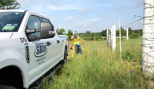
1. Centerline Mapping:
Pipeline operators are obligated under 49 CFR 192 Subpart O to identify the segments of their lines that pose the greatest risk to the public – otherwise known as High Consequent Areas (HCA) and now Moderate Consequent Areas (MCA). Because of the heightened risk to life, property, and the environment, operators must survey the entire pipeline system to identify and maintain the segments within HCAs. Understandably, these HCAs require comprehensive Integrity management programs. But despite these clear requirements, a “review of Pipeline and Hazardous Materials Safety Administration (PHMSA) and state data from ‘first-round’ Integrity Management inspections indicated a large percentage of intrastate and small operators have been inconsistent in determining HCAs using ‘identified sites.’”
The Potential Impact Radius (PIR) calculation stands as a key component of pipeline operators’ risk mitigation strategies. A PIR measures the radius surrounding a potential point of failure, otherwise known as a Potential Impact Circle (PIC). And while PHMSA allows for a “buffer zone” to help operators account for inaccuracies in that calculation, the better and safer approach is to minimize or eliminate inaccuracies altogether. By conducting pipeline centerline surveys in these areas of PIR analyses, the inaccuracies are eliminated and allow for pinpoint consequent areas to be identified and reported as well as providing a backbone of data for related asset materials to be tied back to the operators MAOP validation for traceable, verifiable, and complete record compliance.
2. Inline Inspection Tool Tracking Surveys:
For inspection, Inline Inspection Tools (otherwise known as PIGS or ILI Tools) can be fitted with various Nondestructive Examination (NDE) Technologies that can scan the pipe through which it travels. These are often referred to as “smart pigs.” There are several different types of smart pigs utilized in ILI activities, each with its own set of advantages and disadvantages. Some are more effective at detecting certain types of corrosion or damage in different types of pipes, depending on their NDE capabilities. Knowing where and when these tools travel past known locations along the pipeline’s centerline corridor is crucial for determining follow up integrity management activities and or finding the tool’s location if problems were to occur. Utilization of tracking technology in combination with field personnel, ensures the tool’s location is known and plotted with distance versus time, allowing the Operator to tie the tools data back to the areas of concern for follow up integrity related measures.
3. Close Interval Surveys:
The basic principle of Close Interval Surveys (CIPS or CIS) are to collect and record pipe-to-soil measurements at known intervals along a pipeline’s centerline. Knowing the levels of cathodic protection along the centerline corridor allows the operator to identify pipeline external corrosion anomalies/areas and correlate that data back to other integrity related assessment tools (ie. ILI tools). CIS not only provides information on locations along the pipeline where external metal loss has occurred or may be occurring, but it also provides valuable information to identify the probable cause of external corrosion and to develop mid- and long-term plans to effectively mitigate it.
By utilizing these tools and techniques, operators will be well prepared to meet regulatory demands and federal requirements.
SAM provides services to support Operations, Field Engineering, Right-of-Way, and Integrity Management Programs. NACE & Op-Qual Certified Compliant Staff are equipped for projects of any size or complexity. If you would like to learn more about these and other SAM, LLC Services, please contact us.