

| Adam Long
Collecting and managing accurate utility location data can be a time-consuming and complex process that produces data that is difficult to visualize, evaluate, and then share with stakeholders.
Across the industry, there are various approaches to address this challenge. By adopting a data-first methodology to integrate all of the data in one place, you can simplify the review process at multiple stages.
For example, a program or application combining LiDAR-enabled existing surface condition models and 3D SUE deliverables has the potential to provide the visual context for an entire project area all at once in a format that is easily accessible by all the stakeholders involved in a project. A mobile platform of this type can support engineering and infrastructure projects by making collecting and managing accurate utility location data much more user-friendly, saving your team’s time and effort, and making it easier to view the process.
Improving Quality Control Processes
Adopting a data-first approach can simplify parts of your Quality Control (QC) processes. A robust QC process is necessary to ensure the accuracy of your utility location data. But, while adding more steps can feel like adding fail-safes, adding too many can create “QC fatigue” and erode the quality of those checks. Simplifying these processes allows you to fully utilize your team by freeing them up to solve more complex problems or focus on higher-level reviews without being bogged down by data entry minutiae.
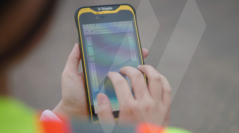
By digitizing and having field crews complete a digital form on-site and uploading it directly into the system, engineers can review the information directly and in real-time rather than transcribing it from a printed form. This goes a long way towards eliminating transcription errors or miscommunications between those on-site and those back in the office. Digital data collection by field crews also provides immediate, visual graphic feedback so the crew can correct obvious data errors immediately, such as entering 100 foot for depth, instead of 10. The error would be obvious in the 3D field view of the data.
At first glance, it can be easy to assume this removes an opportunity for the engineer to review the form. In reality, now that they’re not focused on compiling hard copies into digital model form, they can focus on the high-quality review of information and catch more errors or red flags. This kind of model automation is the future, and it’s something that new graduates in the industry expect when they join the workforce.
Gaining the Ability to Collect More Data Easily
We all know that collecting more data on-site is advantageous, but managing that data after collection can be difficult. With limited bandwidth, it can be easy to feel that the tradeoff for more information is a loss of speed or accuracy.
A data management platform that can be accessed via a mobile application from anywhere allows you not to have to make that compromise. Collecting and documenting information in the field can be as simple as sending a text or checking a box on a tablet. When the related data is input directly into our system on-site, it is easy to access in the future and adds value for clients without putting an undue burden on your crew.
A digital management platform can also be a tool for better visualization of your model data. Rather than collecting and seeing discrete points of data sets, a system like this allows you to see a realistic overall portrayal of everything underground in a given area. Having this kind of complete view can make visualizing patterns in that data easier.
Continuous Platform and Process Improvement
To get the most out of the digital system, you should be continually looking for new ways to mature your data collection and management and refine the processes you have in place.
It’s true that ongoing maintenance is a commitment. However, at SAM, we have found the investment is worth it. Our proprietary application, SAM VantageTM, allows us to use more tools and gather more data without sacrificing speed or accuracy. In fact, those things are steadily improving even as we deliver more to the client.
We recently took steps to reduce QC fatigue for our engineers by integrating test hole data into SAM VantageTM by replacing paper-based workflows with a more efficient, digital process. We have taken advantage of the ease of data collection by beginning to capture centimeter-level positioning for every test hole with the Trimble DA2 Catalyst GNSS System. We are also integrating data from our ImpulseRadar Raptor Ground Penetrating Radar (GPR), a state-of-the-art, high-speed, 3D-GPR Array for high-fidelity subsurface mapping and visualization into our system to create a 3-D, augmented reality map.
Digitizing and adopting a data management system like SAM VantageTM allows you to streamline and automate your processes, increase the amount of data you can collect, and simplify the data management on the back end. Watch our Innovation Series video to learn more about how we have been leveraging the advantages of digitizing data into a single system.