%20(1).png)
Vegetation Management
SAM collects near-infrared (NIR), thermal, corona and RGB imagery that is utilized for decision support for:
- Vegetation health and encroachment
- Condition based maintenance programs
- T&D infrastructure structure and component inspection

In-Action
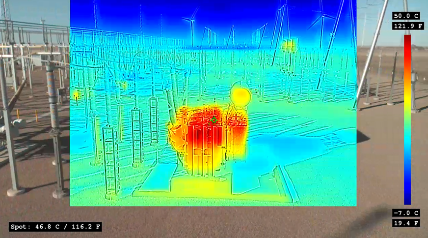
Thermal imagery collected at close range using unmanned aerial systems can be used to detect anomalies for electric distribution and transmission components. RGB imagery is collected simultaneously with the thermal imagery for a side-by-side comparison of electric infrastructure to identify components that may fail, thus improving reliability and avoiding electric outages.
%20(872%20%C3%97%20484%20px).png?width=872&height=484&name=Transportation%20photo2%20(940X788)%20(872%20%C3%97%20484%20px).png)
Advantages
SAM offers a variety of remote sensing services to supplement and support design, planning and operation and maintenance for the electric utility markets. SAM has adopted the use of several complimentary technologies to support a full suite of geomatic services, allowing our clients to benefit from a faster, more economical method of non-destructive inspection.
%20(872%20%C3%97%20484%20px)%20(1).png?width=872&height=484&name=Transportation%20photo2%20(940X788)%20(872%20%C3%97%20484%20px)%20(1).png)
SAM Difference
SAM is committed to adopting the industry’s best remote sensing technologies, and we work closely with the AEC professionals to capture more valuable, complete, and high resolution spatial datasets, in the most efficient way for analysis, reporting and decision support.
