Advantages of Dormant Vegetation and Post-Harvest Timing
To maximize your program's accuracy and efficiency, understanding when you acquire LiDAR and aerial photography services is almost as critical as how. During dormant vegetation and post-harvest periods, the landscape is in a state of minimal biological activity. This, in turn, offers several key advantages that are proven to achieve superior outcomes:
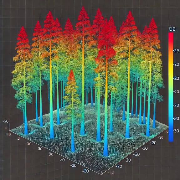
- Improved Visibility: With barren trees and harvested crops, less vegetation obstructs the view of the ground. This allows for more accurate and detailed data collection, as LiDAR and aerial sensors can penetrate more effectively to capture the true contours and features of the terrain.
- Increased Accuracy: The absence of dense foliage and other vegetation reduces the noise in the data, leading to cleaner and more precise models. This is crucial for topographic mapping, land use planning, and environmental monitoring, where accuracy is paramount.
- Efficiency in Data Processing: When vegetation is sparse, the data collected requires less post-processing to remove or correct for the interference caused by leaves, branches, and other organic matter. This streamlines the workflow, reducing the time and cost associated with data processing and analysis.
- Optimal Light Conditions: Dormant periods often coincide with lower sun angles, which can reduce shadow effects in aerial photography. This results in more precise, uniform images that enhance the quality of the data and the insights derived from it.
- Cost-Effective Operations: Conducting LiDAR and aerial surveys during these periods can be more cost-effective, as the need for repeat surveys due to data obstructions is minimized. This ensures that projects are completed on time and within budget without compromising the quality of the results.
Timing the acquisition of LiDAR is a strategic decision that maximizes the accuracy, efficiency, and overall value of the data collected.

Best Months for LiDAR Acquisition in Different U.S. Regions
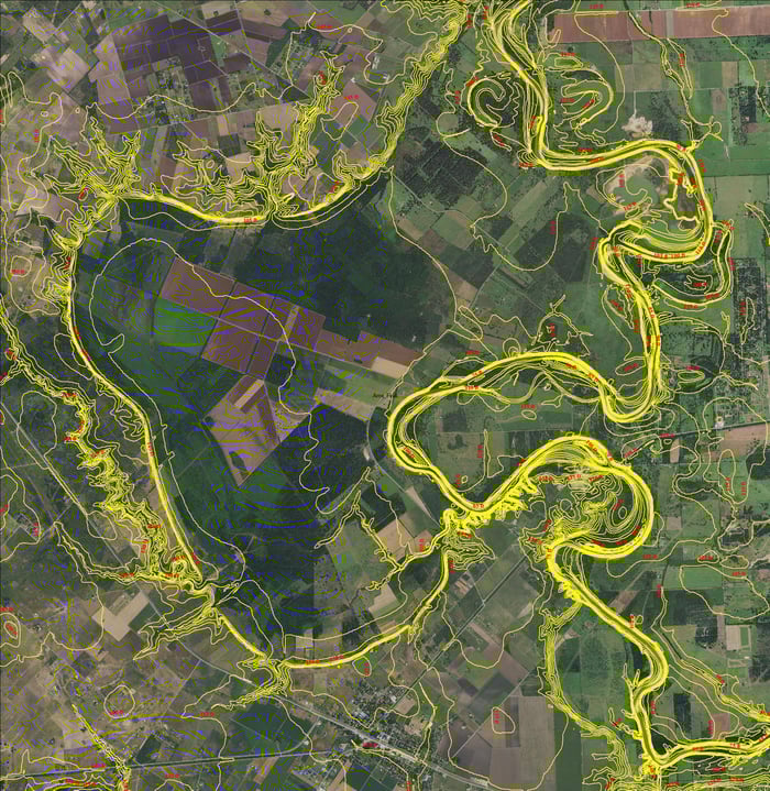
Timing can be based simply on geographic location considering the regional climate. Across the US, general considerations include climate variability, snow and ice patterns, agricultural cycles, and precipitation patterns. In general, the best months for LiDAR acquisition are:
- Northern United States: November to April
- Middle United States: December to March
- Southern United States: January to February
Cost Savings through Bundling Project Sites
Bundling several programs together can lead to significant cost savings in aerial LiDAR acquisition through various strategic mechanisms. Economies of scale are realized, reducing the per-unit cost of LiDAR data, and fixed costs such as equipment setup and mobilization are spread across all sites, lowering expenses for each project. Additionally, due to the larger scope of work, bulk discounts from vendors become more accessible, allowing project managers to negotiate more favorable rates.
The process also minimizes mobilization and demobilization costs, as LiDAR equipment and personnel only need to be transported once, covering multiple sites in a single trip. Optimized flight paths further reduce the number of trips, saving time and fuel. Shared overhead expenses, such as administrative costs and resource allocation, are also reduced, increasing efficiency by managing one bundled project instead of multiple separate ones. This streamlined approach accelerates data collection, processing, and delivery, leading to quicker project completion and reduced labor costs.
Data consistency and quality are improved when bundling, as uniform standards and equipment are used across all sites, ensuring seamless integration of datasets. The comprehensive coverage provided by larger projects adds value to the LiDAR data, allowing for more extensive cross-site comparisons. Bundling also enhances risk management by enabling teams to quickly pivot to nearby sites if unexpected conditions arise at a specific location, thereby reducing downtime.
Building long-term partnerships with service providers also becomes more feasible, potentially leading to ongoing cost savings and improved service for future projects.

Benefits of Using the Same Firm for Multiple Services
Engaging 1 firm for multiple tasks on a singular program provides several key advantages, including:
- Consistency and Accuracy
- Improved Communication and Coordination
- Cost-Effectiveness
- Time Efficiency
- Enhanced Quality Control
- Comprehensive Understanding of Project Scope
Likewise, integrating Geographic Information Systems (GIS) and Building Information Modeling (BIM) makes a significant positive contribution to your program. By integrating real-time data, GIS and BIM enable live monitoring of infrastructure, allowing for proactive maintenance and quicker issue resolution. GIS tools facilitate spatial analysis to optimize operations, such as logistics route planning or determining the most efficient facility layout. Additionally, BIM provides 3D visualization of the infrastructure, which aids in planning, decision-making, and effective communication with stakeholders.
In terms of asset management, GIS creates a comprehensive geospatial database of infrastructure assets, making information easily accessible and improving asset tracking and management. BIM supports lifecycle management by providing detailed information on the infrastructure's components and systems, enabling effective management from construction through decommissioning. The combination of GIS and BIM also allows for predictive maintenance, reducing downtime and extending the lifespan of assets by analyzing historical and real-time data.
Moreover, the integration of data across platforms through GIS and BIM provides a unified basis for analysis and decision-making. These systems support scenario planning by enabling simulation and modeling of future expansions or modifications, helping stakeholders visualize potential impacts. Regulatory compliance and reporting are also enhanced through automated systems in GIS and BIM, ensuring adherence to standards and maintaining detailed audit trails for transparency and accountability.
Collaboration and communication are improved as well, with BIM models being easily shared among teams and stakeholders, facilitating ongoing collaboration throughout the infrastructure's lifecycle. GIS and BIM's visualization tools enhance stakeholder engagement by offering clear and understandable project representations.
Lastly, GIS aids in disaster preparedness and resilience planning, mapping risks, and analyzing potential impacts of climate change or natural disasters to ensure that infrastructure is built to withstand future challenges.
Advantages of Local and Regional Aircraft and Crews
Local and regional crews provide cost-effective, reliable, and efficient service, improving project outcomes and client satisfaction.
- Reduced Mobilization Costs
- Faster Project Turnaround
- Increased Familiarity with Local Terrain, Climate, and Regulations
- Improved Reliability and Risk Management
- Enhanced Client Engagement and Communication
- Tailored Solutions and Expertise
- Scalability and Capacity for Large Projects
- Environmental and Community Impact
- Operational Flexibility and Resilience
For clients, engaging aerial mapping and survey firms with locally and regionally distributed aircraft and crews offers numerous benefits, including cost savings, faster project completion, enhanced reliability, and better alignment with local conditions. These advantages lead to improved project outcomes, greater client satisfaction, and more efficient and effective survey operations. Clients can expect a service that is not only technically proficient but also responsive and well-integrated with the local environment and community.
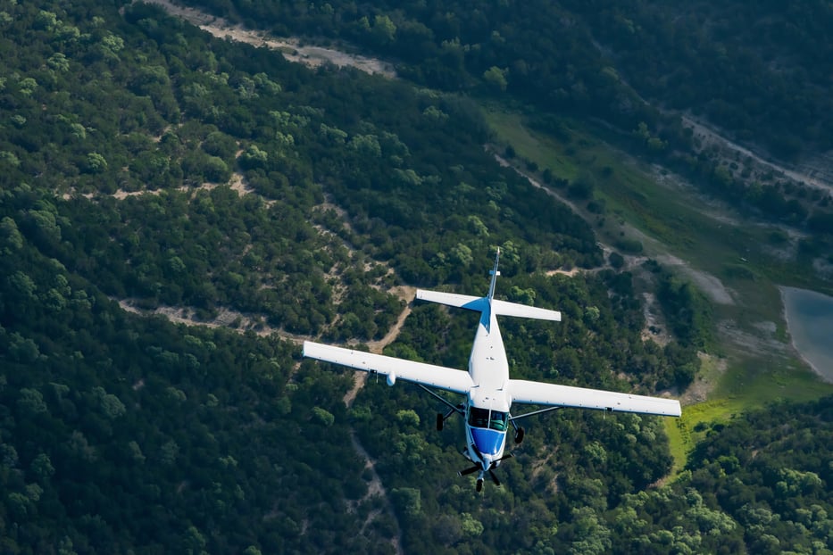
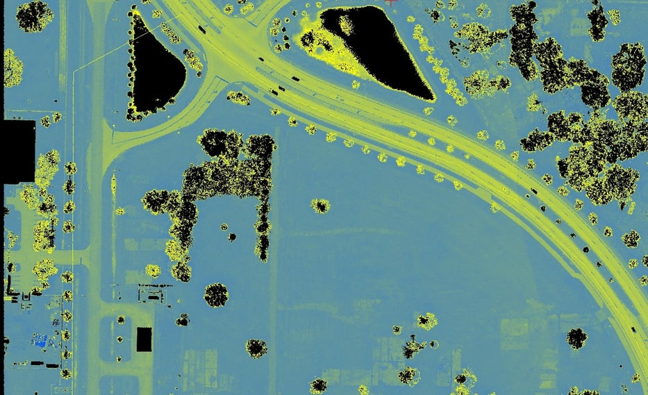
LiDAR Data Acquisition Capacity
The amount of LiDAR data that a modern fixed-wing aircraft can acquire in a single day varies based on several factors, including the type of LiDAR system, aircraft capabilities, and environmental conditions. Generally, a modern fixed-wing aircraft equipped with an advanced LiDAR system can acquire between 150 to 400 square miles of data per day. Here are some key variables that may affect the data:
- LiDAR System Specifications - The specifications of the LiDAR system significantly impact the data collection process. A higher laser pulse rate allows for the capture of more data points per second, enabling greater coverage of the survey area. A wider field of view (FOV) permits the scanning of larger swaths of land with each pass, further increasing coverage. However, higher sensor resolution may require slower flight speeds or more passes to achieve the necessary data density, which can influence the overall area covered.
- Aircraft Capabilities - The capabilities of the aircraft play a crucial role in determining the efficiency of the LiDAR survey. Faster aircraft can cover more area within a given time frame, though this speed must be balanced against the need for data quality. Flying at higher altitudes allows for the coverage of larger areas, but this may come at the expense of resolution and accuracy, depending on the project's requirements and the LiDAR system's capabilities. Aircraft with greater endurance can operate for longer periods without refueling, thereby increasing the area covered in a single day.
- Project Requirements - Specific project requirements can also affect coverage. For example, projects requiring high point density, such as urban mapping or detailed topographic surveys, may necessitate slower flight speeds or multiple passes, which can reduce the daily coverage area. High accuracy demands might require lower altitudes or slower speeds, impacting how much ground can be covered. Additionally, the need for overlap between flight lines to ensure data quality and consistency can further reduce the effective area covered during each pass.
- Terrain and Vegetation - The nature of the terrain and vegetation in the survey area can greatly influence the efficiency of LiDAR data acquisition. Rugged or varied terrain may require more complex flight paths and altitude adjustments, which can decrease coverage efficiency. Dense vegetation can necessitate lower altitudes or multiple passes to ensure sufficient ground penetration, thereby affecting the rate at which data can be acquired.
- Weather Conditions - Weather conditions are a critical factor in LiDAR operations. Poor visibility due to fog, rain, or snow can impede data collection or necessitate postponements, reducing the available flight time. Additionally, strong winds can impact the stability and speed of the aircraft, potentially affecting both data quality and coverage.
- Operational Considerations - Effective flight planning and execution are essential for maximizing coverage during LiDAR surveys. Efficient planning can prevent overlaps and gaps in data collection, thereby improving efficiency. Regulatory constraints, such as airspace restrictions or required permits, can limit the areas and times when LiDAR can be collected, which impacts daily coverage. Finally, real-time data processing and quality checks enable dynamic adjustments to operations, ensuring maximum efficiency throughout the survey.
While theoretically possible to cover up to 692 square miles, real-world constraints such as overlap requirements, topography, and point density typically reduce the practical daily coverage.
Multiple Sensor Aircraft and its Benefits
Using fixed-wing aircraft equipped with multiple sensor payloads provides clients with a versatile, efficient, and cost-effective solution for comprehensive data collection. Integrating various sensors in a single flight operation not only improves data quality and accelerates project completion but also enhances decision-making capabilities, making this approach valuable across numerous industries.
- Comprehensive Data Collection: By combining different sensors, a single flight can capture a wide range of data types, including topographical information, high-resolution imagery, and multispectral data. This integration supports detailed analysis for applications such as environmental monitoring, urban planning, and agriculture.
- Cost Efficiency: Conducting data collection from multiple sensors in a single flight reduces the need for multiple missions, leading to significant savings in flight hours, personnel, and equipment mobilization. Clients may also benefit from bundled services, lowering overall project costs.
- Time Efficiency: Multi-sensor payloads allow for faster project completion by simultaneously capturing different datasets, reducing the time from data collection to analysis and decision-making. This capability is especially beneficial for projects with tight deadlines.
- Improved Data Accuracy and Quality: The complementary nature of different sensors enhances overall data quality. For instance, LiDAR provides precise elevation data, while cameras offer detailed visual imagery, and cross-validation between these datasets ensures accuracy.
- Increased Flexibility and Versatility: Multi-sensor payloads allow aircraft to adapt to various project requirements, whether for urban mapping, agricultural analysis, or environmental assessments, making the same platform suitable for multiple applications.
- Enhanced Geospatial Analysis: Combining LiDAR with oblique cameras enables the creation of accurate 3D models, while multispectral sensors offer insights into vegetation health and land use, providing data not visible with standard imagery.
- Improved Operational Efficiency: Integrated systems, such as GPS and IMUs, provide precise location data and orientation, improving georeferencing and reducing post-processing time. Real-time weather data further enhances flight planning and data collection.
- Enhanced Decision-Making: Comprehensive and accurate data enables clients to make informed decisions, optimizing project outcomes and resource allocation. Real-time monitoring allows for immediate analysis, crucial for emergency response or time-sensitive projects.
- Environmental and Safety Benefits: Reducing the number of flights needed minimizes the environmental impact and enhances safety by lowering exposure to aerial risks, benefiting both crew and equipment.